Category: Maps

There are several interesting projects happening out at Cape Blanco involving photography, maps and nature — three of our favorite things at Port Orford Historical Photos. The first…
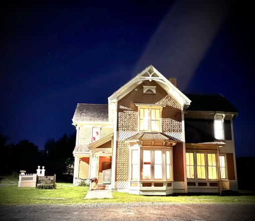
The Hughes House and Ranch is a well-known destination on the Southern Oregon Coast nestled in Cape Blanco State Park at the mouth of the Sixes River. Each…
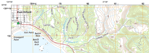
We’re big fans of maps at Port Orford Historical Photos, and we were delighted to discover this extraordinary documentation of “The Port Orford Quadrangle” by Joseph Silas Diller…
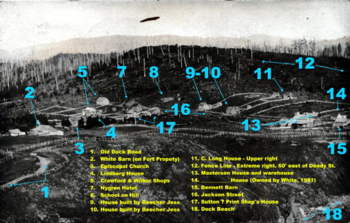
Enjoy this historical photo mapped by Alan Mitchell using notes from historian Pat Masterson: