Menu Close
© 2026 Port Orford Historical Photos.
YOU ARE HERE → 351.ARCHIVE.
Powered by Point.B Studio
Map by USGS Topoview.
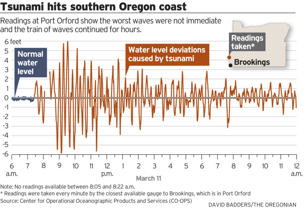
See also: “Oregon Field Guide – Coastal Tsunami” Season 8, Episode 4.
← Previous post
Next post →
Your email address will not be published. Required fields are marked *
Comment *
Name *
Email *
Website
Δ
This site uses Akismet to reduce spam. Learn how your comment data is processed.

Leave a Reply