
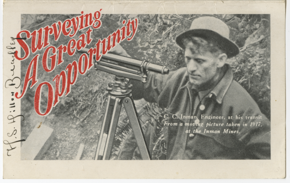
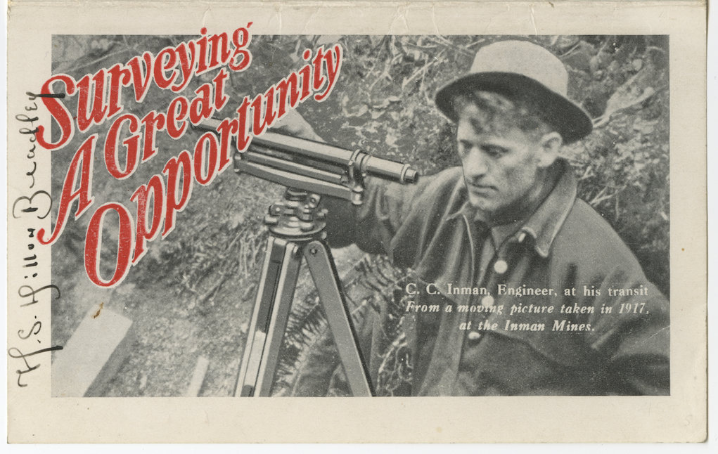
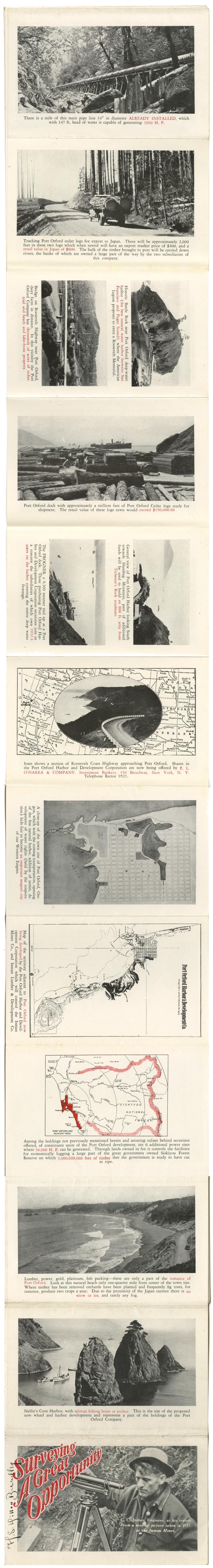
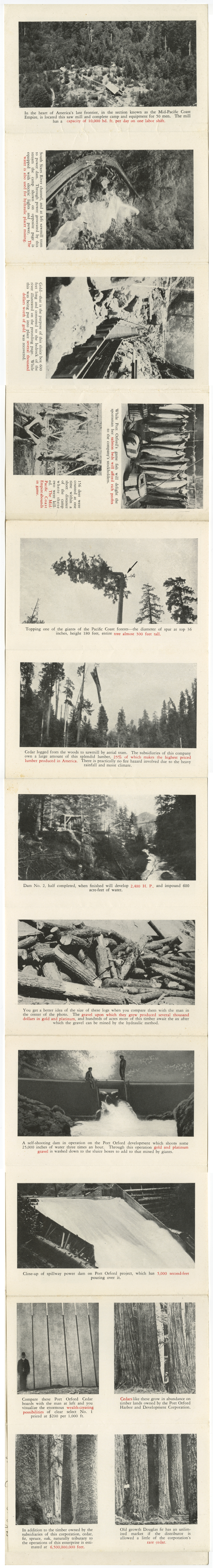
Cover of a multiple-fold two-color brochure from 1917 from the Port Orford Harbor and Development Corporation. The material was intended to promote stock offerings in the organization. Featured on the cover is a still from a ‘moving picture’ of Claude C. Inman of the Inman Mine Company in Sixes, OR, which comprised 30 mining claims and owned 2.5 miles of the Sixes River below and above the forks. — (Source: Port Orford and North Curry County by Shirley Nelson).
Scans of the entire brochure will be added here as they become available and to the Port Orford Historical Photos archive. Please click the thumbnail images to see the brochure at full size.
Bob Fisher
As a young student at Port Orford Grade school in the early 1940s I lived on the upper Elk River–Very remote–I also spent much time with the trappers/Miners who lived close to the head of the river .During this time and later years also-I observed many old mining operations and Cabin sites–some of these mining operations were very old (maybe in the 20s–) others were ongoing–I am trying to obtain a forestry map of this era so that I can chart these locations –Can You advise ??
Rebecca
Hi Bob —
You may find USGS topoview very useful. Follow this link and type in “Elk River, OR” in the search field. Select the “HTMC” ( Historical Topographic Map Collection) option and you will see USGS Quadrangles dating back to 1899.
https://ngmdb.usgs.gov/topoview/viewer/#11/42.7581/-124.3711
I hope this helps in your research!
Rebecca
PS. Apologies for the delay in answering your question!